
The urban government of Valencia developed a network to use the rapid movement of information to their advantage as well as to control the flow of important information when possible. Information itself very quickly took on the aspects of a luxury good – light weight, highly valuable, regularly transmitted with bulk commodities, but sometimes worth sending alone and at high cost. Depending on the type of information and the value to the city, Valencia could both collaborate with other administrations to transmit messages as effectively as possible, or use secrecy and speed to make decisions in their own interest. In the essay, I look at several examples of collaboration and competition in the spread of information, focusing on piracy, war, the city grain supply, and a prominent court case over the control of the regional town of Cullera. Additionally, the essay gives a fuller description of the integration between runners, animal travel, ocean travel, and official representatives stationed at politically important posts around Valencia’s sphere of influence.
The following maps are representations of the text and early attempts to display Valencia’s network. All three were made with QGIS, which is effective but has some restrictions. Clicking on the image will open a much larger (and more legible) version of the map. The first map is only a reference for many of the smaller towns and locations mentioned in the text:

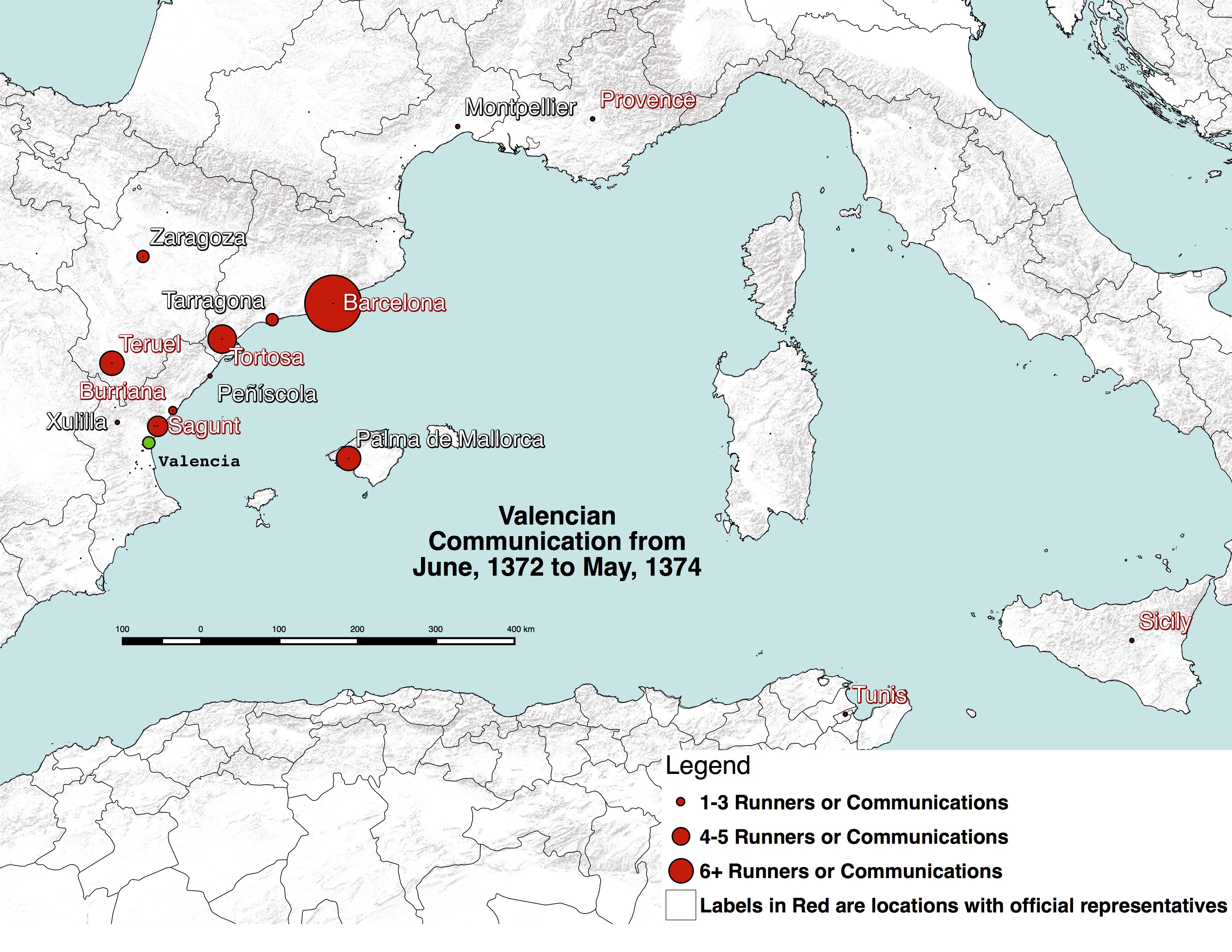
The second map is a first attempt to represent the most common locations that Valencia communicated with over a two year period. There are, in fact, numerous problems with this map. First, every two years tends to have new concerns and hence new focal points of communication; hence this is only especially useful for these two years. Beyond that, not all communications are registered in the Clavaria, so the data set feels suspiciously incomplete. Finally, the most notable parts of the map demonstrate relatively straight forward facts: Valencia communicated most with the royal administration in Barcelona and with their frequent trading partners (especially for grain) in Tortosa. In the future, I want to try to design a map of this sort for the correspondence collection in Valencia that would, at the very least, be a more concrete data set.
And finally, a heat map version of the same thing…for experimental purposes:
[under construction…]